Industrial drones are used for infrastructure inspection, surveying, precision agriculture, public safety, environmental monitoring, and cargo transportation. The right aircraft depends on what the mission needs to accomplish: capturing detailed images, measuring temperature, mapping large areas, applying agricultural materials, or transporting equipment.
For enterprise buyers, choosing between commercial drones is not simply a matter of flight time or camera resolution. Airframe design, sensors, payload capacity, software compatibility, and operating conditions determine whether a UAV can complete a particular task reliably.
The following comparison covers seven major industrial drone applications, the equipment typically required, and the technical considerations that matter before purchasing a professional UAV system.
What Are the Main Industrial Drone Applications?
Industrial drone applications fall into seven practical categories, each with different equipment and operational requirements.
| Industrial Application | Typical UAV System | Main Equipment or Payload | Primary Buyer Consideration |
| Power and utility inspection | Multirotor inspection drone | Zoom camera, thermal camera | Image detail, safe standoff distance |
| Construction and surveying | RTK mapping drone or VTOL UAV | RGB camera, positioning system | Mapping accuracy, survey coverage |
| Oil, gas, and pipeline inspection | Multirotor or long-range VTOL | Optical and thermal sensors | Corridor coverage, inspection data |
| Agricultural monitoring | Multispectral mapping drone | RGB and multispectral cameras | Crop data quality, processing workflow |
| Agricultural spraying and spreading | Agricultural multirotor | Spraying or spreading system | Capacity, application control |
| Public safety and emergency response | Enterprise multirotor or VTOL | Zoom, thermal, spotlight | Deployment speed, live situational awareness |
| Industrial cargo transportation | Heavy-lift multirotor | Cargo mounting or lifting system | Loaded endurance, payload safety |
These categories describe missions rather than mutually exclusive aircraft designs. An enterprise multirotor, for example, may perform both utility inspection and emergency response after its equipment and operating procedures are appropriately configured.
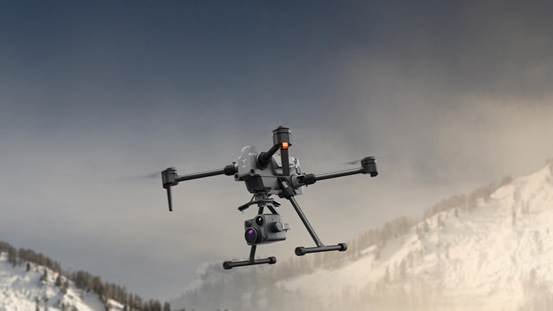
1. How Are Industrial Drones Used for Power and Utility Inspection?
Power line inspection drones help utility operators examine transmission lines, substations, and electrical equipment without requiring inspectors to approach every elevated component.
High-resolution optical cameras can document visible problems such as damaged insulators, corrosion, missing components, or deteriorated hardware. Thermal imaging adds another layer of information by identifying temperature patterns that may warrant further electrical investigation.
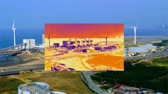
Different inspection tasks require different camera configurations.
For detailed visual inspections, an enterprise drone with optical zoom can capture equipment images from a suitable distance. Thermal inspections require an infrared sensor with appropriate thermal resolution, measurement range, and calibration.
The DJI Matrice 4TD combines optical cameras with thermal imaging capabilities, making it relevant to utility asset inspection.
Buyers should evaluate camera resolution, zoom capability, flight stability, obstacle avoidance, operating temperature, and the format of inspection data.
A thermal image alone does not establish the cause of an electrical fault. Results should be interpreted alongside equipment conditions, operating load, and qualified maintenance procedures.
2. How Do Surveying Drones Support Construction and Mapping Projects?
Drone surveying enables construction teams to collect aerial imagery and position data for terrain mapping, site measurements, and project documentation.
Unlike a conventional site photograph, a properly planned mapping flight collects overlapping images that can be processed into orthomosaics, elevation models, and three-dimensional representations.
RTK positioning can improve image geolocation and support more efficient mapping workflows. However, project accuracy still depends on camera calibration, flight planning, control points where required, and independent survey checks.
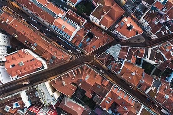
The DJI Matrice 4E is designed for professional surveying and mapping, combining an imaging system with features such as a mechanical shutter and dedicated mapping functions.
For smaller construction sites requiring repeated close-range surveys, a multirotor is often practical because it can take off from a compact area and follow controlled flight paths.
For extensive terrain or infrastructure corridors, a fixed-wing or hybrid VTOL aircraft may provide more efficient area coverage.
The Autel Dragonfish Pro represents a hybrid VTOL option for longer-duration missions.
Construction buyers should define required map accuracy, output formats, site dimensions, vegetation conditions, and software compatibility before selecting an aircraft.
3. What Can Drones Inspect in Oil, Gas, and Pipeline Operations?
Industrial UAVs support oil and gas inspections by collecting visual, thermal, and georeferenced information from pipelines, storage facilities, and remote infrastructure.
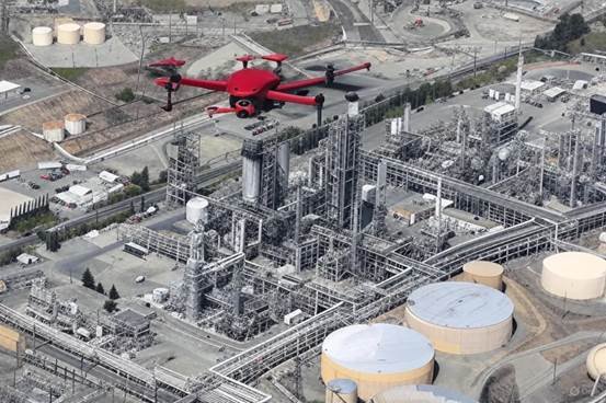
Pipeline operators manage assets that may extend across difficult terrain. Drone imagery can help document the condition of accessible pipeline sections, surrounding land, access routes, and exposed infrastructure.
Close-range multirotor inspection is useful around valves, tanks, processing facilities, and individual structures. Longer-range aircraft can be more suitable for surveying extended pipeline corridors.
Sensor selection matters.
An RGB camera provides detailed surface imagery. A thermal camera records temperature differences that may help identify anomalies under suitable conditions. Detecting specific gas emissions requires a compatible gas-detection instrument and an appropriate measurement method.
A standard thermal drone should not be described as a universal gas-leak detector.
For procurement, request a clear distinction between visual asset inspection, thermal inspection, and direct gas sensing.
Inspection contractors should also confirm flight permissions, hazardous-area restrictions, data ownership, and reporting requirements before deployment.
4. How Are Agricultural Drones Used for Crop Monitoring?
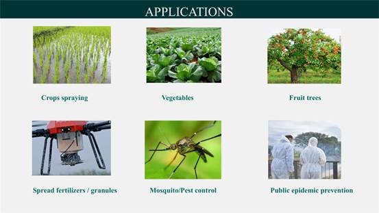
Agricultural monitoring drones collect aerial data that helps farmers and agricultural service providers assess crop conditions and identify areas requiring closer attention.
RGB cameras produce detailed visual images of fields, crop patterns, and visible damage. Multispectral cameras measure reflected light in selected wavelength bands, enabling vegetation indices and other crop-analysis workflows.
These measurements can support crop vigor assessment, field variability analysis, and targeted scouting.
The DJI Mavic 3M Multispectral Drone combines a 20 MP RGB camera with four multispectral cameras covering green, red, red-edge, and near-infrared bands.
Its imaging system is relevant to professional agriculture UAV applications involving crop observation and geospatial data collection.
Multispectral imagery does not automatically diagnose a particular disease or nutrient deficiency. Field observations, agronomic knowledge, and appropriate ground measurements remain necessary.
Agricultural buyers should consider field area, sensor bands, radiometric consistency, mapping software, and the intended decisions that will be made from the imagery.
A monitoring drone is primarily a data-collection tool. Spraying and seeding require a different operational configuration.
5. What Is the Difference Between Agricultural Spraying and Spreading Drones?
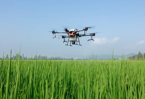
Agricultural spraying drones distribute liquid materials, while spreading drones apply granular products such as suitable seed or fertilizer formulations.
These applications are related, but the dispensing equipment and calibration requirements differ.
A spraying system typically uses a tank, pumps, hoses, and nozzles or atomizers. Buyers need to evaluate flow rate, droplet characteristics, spray width, target application rate, and crop coverage.
A granular spreading system requires a suitable hopper, feeding mechanism, and distribution system. Material size, flowability, and distribution uniformity affect performance.
The XAG P150 Pro supports agricultural operating configurations that include spraying and spreading.
For agricultural contractors, the best choice depends on the material being applied and the actual field conditions.
A drone suitable for broad-acre crop spraying may need different settings or equipment for orchard work. Product labels, local aviation rules, and applicable pesticide regulations must also be followed.
Before procurement, request the equipment configuration, application-rate controls, replacement-part information, battery requirements, and calibration procedures.
6. How Do Enterprise Drones Support Public Safety and Emergency Response?
Public safety drones provide aerial situational awareness during search and rescue, firefighting assessment, infrastructure incidents, and security operations.
An aircraft equipped with optical zoom can help incident teams observe hazardous locations from a suitable operating distance. Thermal sensors may assist with detecting heat signatures, particularly when visible-light conditions are difficult.
For a search operation, the useful equipment may include a thermal camera, optical zoom, a searchlight, and reliable video transmission.
For industrial emergency assessment, operators may prioritize rapid deployment, stable flight, and images that help responders understand damaged infrastructure.
Professional multirotor drones are well suited to many short-range observation tasks because they can hover and reposition around a particular scene.
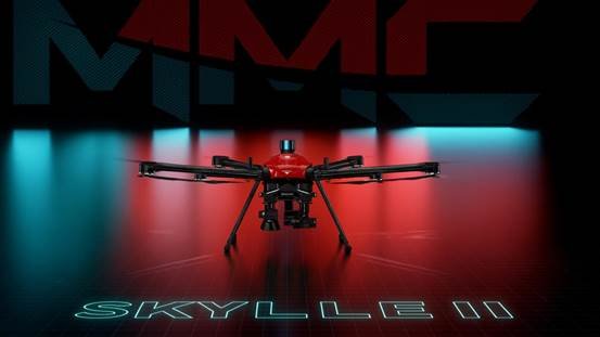
Longer-duration VTOL platforms may suit wider-area observation where operational permissions and mission conditions allow.
The aircraft is only part of an emergency response system. Teams also need trained personnel, communication procedures, airspace coordination, and a plan for handling recorded images.
Buyers should assess deployment time, equipment reliability, low-light capability, video access, and the compatibility of optional payloads.
7. What Are Heavy-Lift Drones Used for in Industrial Logistics?
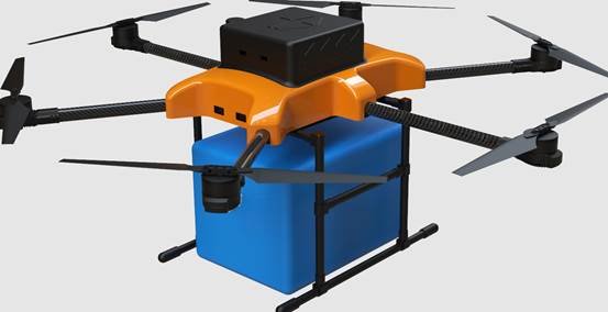
Heavy-lift cargo drones transport equipment, tools, and supplies when conventional ground access is difficult or when an aerial delivery route is operationally appropriate.
Potential applications include moving materials to remote construction locations, delivering equipment along utility corridors, and transporting supplies to hard-to-reach industrial sites.
Cargo UAVs differ substantially from camera-focused enterprise drones.
The decisive specifications include usable payload, loaded flight endurance, mounting arrangements, stability, and procedures for handling an abnormal flight condition.
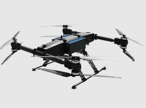
For example, the Mercury X480 Heavy-Lift Transport UAV lists a maximum takeoff weight of 480 kg and a maximum payload capacity of 300 kg.
These figures describe different limits. Maximum takeoff weight is not cargo capacity.
The same product information lists 55 minutes of maximum endurance without a load. Buyers must not assume that this value applies when carrying a full payload.
Transport operators should request performance evidence at their intended cargo weight, altitude, temperature, and route distance.
Cargo attachment and recovery methods also require careful evaluation. Suspended loads behave differently from rigidly mounted cargo and may create additional operational hazards.
For industrial logistics procurement, the mission profile should determine the aircraft—not the largest advertised payload figure.
Which Type of Industrial UAV Is Best for Each Mission?
Multirotor drones are generally suitable for close-range work requiring hovering, while fixed-wing and hybrid VTOL aircraft are useful for missions emphasizing distance and area coverage.
These airframe categories describe how an aircraft flies, not the industry in which it operates.
Multirotor Drones
Multirotor UAVs can take off vertically, hover, and maneuver around structures. They are practical for power line inspections, close-range surveying, public safety observations, agricultural spraying, and certain cargo operations.
Their main trade-off is the energy required to generate lift continuously, particularly with heavy payloads.
Fixed-Wing Drones
Conventional fixed-wing UAVs generate lift through their wings during forward flight. They can be effective for large-area surveys and long corridors but generally cannot hover.
Launch and recovery requirements must be evaluated before choosing this design.
Hybrid VTOL Drones
Hybrid VTOL aircraft combine vertical takeoff and landing with wing-supported cruise flight.
They can be useful when a project requires wider coverage but lacks a suitable runway or launch area. Transition mechanisms, maintenance requirements, and emergency procedures add complexity.
The correct platform depends on the complete mission. A long flight time is not useful if the aircraft cannot carry the necessary sensor or capture the required detail.
How Should Businesses Choose an Industrial Drone System?
Enterprise drone procurement should begin with the required operational result, followed by platform and payload selection.
An effective purchasing evaluation addresses five connected areas.
1. Define the Work and Deliverables
Specify what the UAV must accomplish. A utility company may need defect images linked to asset IDs. A surveyor may require georeferenced orthomosaics. A logistics operator may need documented delivery performance at a particular cargo weight.
Define acceptance criteria before comparing equipment.
2. Match Sensors to the Task
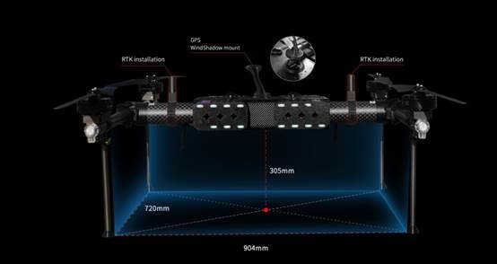
RGB imaging, thermal cameras, multispectral sensors, and LiDAR systems collect different information.
Not every sensor is included with every aircraft. Check installed equipment, supported accessories, and whether third-party integration is actually available.
3. Compare Performance Under Real Conditions
Manufacturers may publish maximum flight time, transmission distance, or payload under specific test conditions.
Buyers should request the corresponding operating assumptions and confirm whether the figures apply to their planned mission.
4. Review Software and Data Requirements
Professional UAV operations often depend on flight-planning software, processing platforms, and repeatable reporting methods.
Verify supported file formats, software licenses, data access, firmware support, and compatibility with existing business systems.
5. Evaluate Maintenance and Regulatory Requirements
Maintenance procedures, spare parts, operator training, batteries, and applicable flight permissions influence long-term deployment.
For international operations, aviation regulations depend on the country, aircraft, mission, and operating conditions. Hardware documentation alone does not establish permission to operate.
A complete procurement request should identify the mission, payload, operational environment, expected outputs, and support requirements.
Frequently Asked Questions About Industrial Drone Applications
What is the difference between a commercial drone and an industrial drone?
A commercial drone is an aircraft used for business activities. An industrial drone typically refers to a commercial UAV configured for professional tasks such as infrastructure inspection, surveying, agriculture, or cargo transportation. The terms overlap, but industrial applications often place greater emphasis on specialized sensors and operational requirements.
Which industrial drones are suitable for thermal inspections?
Industrial drones equipped with compatible thermal cameras can support thermal inspections. Selection depends on thermal resolution, measurement characteristics, operating conditions, and the inspection target. Optical and thermal sensors may be combined when both visual detail and temperature information are required.
Can one enterprise drone perform multiple industrial applications?
Some enterprise drones can support multiple tasks using different software or compatible payloads. However, aircraft payload limits, sensor compatibility, safety requirements, and operating permissions determine which tasks are feasible.
Are industrial drones suitable for autonomous operations?
Certain enterprise UAV systems support automated routes and compatible docking stations. Fully remote or unattended operations require additional planning for communications, charging, site safety, supervision, and regulatory authorization.
What information should buyers provide when requesting an industrial UAV quotation?
Buyers should describe the intended application, site conditions, required payload or sensor, operating distance, expected deliverables, and deployment country. These details help determine whether an existing aircraft configuration is suitable or additional integration work is required.
Choosing an Industrial UAV Solution for Your Project
A suitable industrial drone system should deliver usable results under the conditions in which your organization actually operates.
UUUFLY offers a range of enterprise UAV products covering inspection, mapping, agricultural operations, public safety, and cargo applications. The available portfolio includes professional drones and associated equipment from multiple brands, allowing buyers to compare different mission configurations.
Organizations evaluating new UAV equipment can begin with the industrial inspection drone solutions or review the relevant product models linked throughout this article.
For a more specific recommendation, submit your project requirements, including the application, required sensors, payload, operating environment, and expected data or transport results. These specifications provide a practical starting point for selecting and evaluating an enterprise drone system.